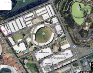
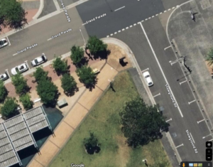
Zoom levels refer to how large (or small) an area the map displays. They range from 0 to about 21, where 22 shows about 2 small house sized buildings, 16 shows about a suburb, and 12 displays large a city/metro area (like all of Melbourne or Sydney). 0 displays the whole world. Max Zoom is higher numbers (up to 21) and shows the smallest amount of ground. Min Zoom is lower numbers (usually down to 16) and shows the most amount of ground.
Depending on the detail in your image overlay and the size of the venue your map covers, these will typically be from 17 (zoomed out to the show the surrounding suburb with your map in the middle) to 21 (zoomed down to so couple of houses fill the displayed map).
The zoom level function allows for the user to scroll with their mouse or use pinch/stretch gestures on phones – to zoom in and out of the map to see markers and landmarks at the desired level of detail.
Here is an image of Googlemaps at Zoom Level 15, showing most of 4 suburbs.
As you zoom in closer you see more detail, but a smaller area. At Zoom Level 21 you can easily make out individual cars, but the map only shows about 60m x 60m of area.


