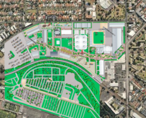
Overlay images let you place an image over the Google map street or satellite view, incorporating features, branding, and customisation of how the map appears for your users. There is an alignment process that lets the system understand how the underlying latitude and longitude that the Google map imagery uses corresponds with the image you provide – this ensures “blue dot” navigation that displays your current GPS location show it on the correct part of your overlaid image.
Note: Ensure you set this as accurately as possible before starting to configure Wayfinding, the wayfinding setup relies on this being set correctly.
· Opacity
-
This function allows for the user to adjust the opacity of the overlay image so you can see the original underlying map image which helps you in better aligning the base map to your created map design as an overlay.

Image overlaid on Google Satellite view


